

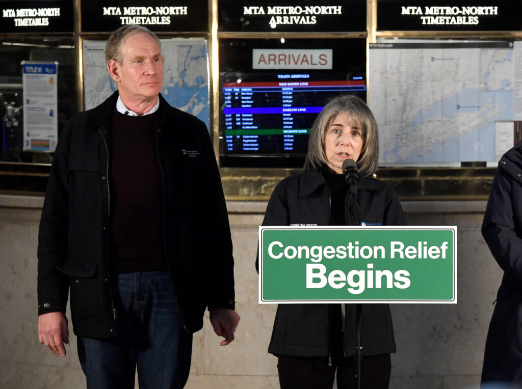
CiTTi Magazine speaks to MTA Bridges and Tunnels’ chief operating officer Allison C. de Cerreño to uncover the secrets behind New York City’s road user charging scheme.
In 1811, the Commissioners’ Plan laid the foundation for New York City (NYC), designing its’ streets in an equally spaced gridiron pattern. Ever since, NYC, launchpad of the American Dream, welcomed people from across the world on streets built for horse-drawn carriages. Unlike Old-World cities however, NYC’s layout proved advantageous as motor cars rose in popularity, with gridirons able to disperse traffic effectively and reduce congestion. What NYC’s urban planners failed to consider was the sheer speed at which the city would grow. From 1.9 million in 1890, NYC’s population ballooned to more than 8 million by the turn of the millennium.
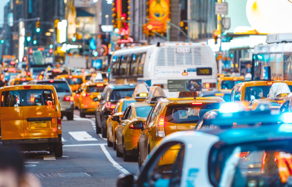
To accommodate the growth, construction was driven into the heavens and under the earth, with skyscrapers and an underground Subway network built to alleviate housing and transit problems. Primarily built on a collection of islands, NYC’s roads had little room to expand, however, with the same grid system that had freed city traffic exacerbating congestion. The frequency of intersections – Manhattan’s north-south blocks average 264 feet apart, while the east-west avenues average 750 feet apart – created phantom traffic jams through stop-start congestion patterns.
By the 1970s, roads were plagued by pervasive traffic jams, a sea of yellow taxi cabs choking the roads a common sight in the Big Apple.
With outward expansion out of the question, city officials began to seriously consider road user charges to reduce congestion. The first plans were proposed by mayor John Lindsay to toll all crossings of the East River, but his successor, Abraham Beame, shelved them. A back-and-forth debate ensued over the next 50 years until in 2017, the then governor Andrew Cuomo commissioned a task force to investigate congestion pricing scheme viability.
In 2019, the New York State Legislature would formally authorise congestion pricing within its budget, tasking its development to the Metropolitan Transportation Authority (MTA) and the New York City Department of Transportation (NYC DOT).
In January 2025, after six years of refinement, the Central Business District Tolling Program was launched in an effort to reduce congestion, fund NYC’s transportation and improve its air quality in the designated Congestion Relief Zone (CRZ).
With its’ population now at 19 million and counting, NYC’s congestion programme arrives at an opportune time. CiTTi Magazine, seeking to understand the challenges surrounding the project’s development, implementation and reception, sat down with one of its chief architects, MTA Bridges and Tunnels’ chief operating officerAllison C. de Cerreño, to delve into the multifaceted complexities affecting the programme’s rollout, including stakeholder coordination, technological integration, and community involvement.
What were the core challenges NYC faced that led to the Central Business District Tolling Program’s inception?
First and foremost, congestion. NYC, especially in the central business district, had been gridlocked for decades. Many things were tried, nothing really worked. We were regularly identified as having the worst traffic congestion in the United States. We had travel speeds in the central business district in the decade between 2010 and 2019, prior to Covid, decline by 23%. Our bus speeds were down by 28%. Transit is the life and blood of the city, so we have a lot of people taking those buses on a regular basis. In 2018, there was a study put out by the Partnership for New York City, which estimated there was a US$20bn-a-year [economic] drag on the New York Metropolitan Area because of congestion. For people themselves, it had been estimated that each driver was losing 102 hours per year and $1,600 roughly per year just sitting in traffic. So first and foremost, that was the issue. Secondarily, our transit system is old and in need of repair and modernisation. We needed funding to invest in improved reliability, committing to environmental sustainability, making sure we have access for everybody, and then further reducing congestion.
FAST FACT: Within three weeks of launch, travel times improved 10-30% and vehicle trips into the zone dropped. Source: MTA Bridges and Tunnels
The more you attract people to transit, the more they’re not on the roads. That’s why we did this. We’d looked at doing it for many years, on and off, but we were fortunate this time that the stars aligned in terms of bringing people together in 2019 to put legislation in place.
We had challenges. Public perception was very similar to what we’ve seen in other places around the world, where when it’s announced, there’s a group that really is interested and wants it, but lots of other people are very concerned and sceptical because it’s a new toll. Just like London and just like Stockholm, we saw public support dip quickly, all the way through, frankly, until went live. After it went live, public support started climbing again because people could see the benefit. Even those who were paying, as stated in one of the studies that came out, ended up liking it the most as they get the most out of clearer roads.
London’s own Ultra Low Emission Zone (ULEZ) and preceding Low Emission Zone (LEZ) schemes are often brought up as points of reference; what other schemes did you look into?
So that’s a funny question. We must start again in 2019 with the legislation, which identified certain components for the programme that we needed to ensure that we incorporate. For example, it had to be a variable toll. It required us to have certain types of exemptions, most notably for vehicles transporting persons with disabilities and for qualifying authorised emergency vehicles. But beyond that, as soon as we got the go that were going to be doing this, we at MTA Bridges and Tunnels, went out and we found subject matter experts from London, Stockholm and Singapore who came to speak with us about the experiences in all three cities.
They spoke about what worked, what didn’t, what could be applicable here, what they would have wished they could have done had their situation been different. A lot of people said, ‘Why can’t you just do what London did?’, and you can’t, because each city is a little bit different.
We had [the speakers] review some of our early documentation and we got their feedback from it. In addition to that, there was a broader discussion that we were implementing this in one of the densest areas in the country and the world – so how do you do that?
You don’t want a giant gantry, for example, that you would have on a normal bridge or near a tunnel. You must have something that fits within the confines of the urban environment. We wanted to make sure that we had the smallest footprint possible that would blend into the communities of NYC. It’s not just cars here, you have people, you have animals, you have all sorts of things happening. You don’t want this to stick out, you want it to just become part of the entire ecosystem, that people just move around and don’t notice on a daily basis.
How did you overcome the issue of public perception, especially in a place where tolling initiatives have been proposed so many times before?
We understood that the scheme would follow the patterns seen in other countries where public perception declines and then eventually rebounds. We were coordinating with multiple entities in the federal government as part of the overall environmental review that we had to do which ties into the key logistical issues of interagency coordination. The NYC DOT and the New York State Department of Transportation (NYSDOT) were part of our formal process for federal review. Early on, before we even put anything out on paper as an environmental assessment, we had 19 early outreach webinars, nine of which were directed at environmental justice communities. We had more than a thousand people sign up to participate, and we received 7,338 comments – all of which we answered.
We also set up an environmental justice technical advisory group and had multiple meetings with them. We had an environmental justice stakeholder working group, one that worked with the technical advisory group. The stakeholder working group allowed people to self-identify as an environmental justice community or a participant and come participate in these smaller forums that we had. We had outreach in nine languages, including English, that we conducted in 28 counties. We made hard copies of the entire document available in each of these counties with locations the public could freely visit. It was also made available online.
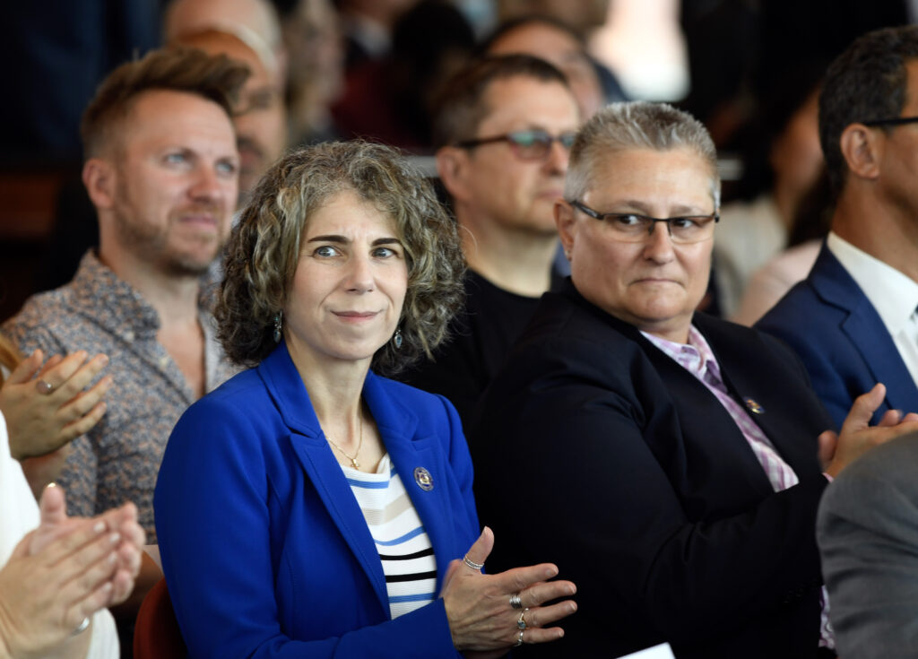
(Marc A. Hermann / MTA)
Eventually, after we put the document out so people could review it and then come back and talk again to us, we continued our smaller working groups. At that point, we had six hearings, the longest of which was seven-and-a-half hours straight well past midnight. From that, we ended up with roughly 70,000 public input submissions. Each of those submissions was then identified into how many comments it had. We had 14,000 individual submissions amounting to 22,000 comments and over 55,000 that we got as part of four different letter campaigns. All of those were responded to. Then, as part of our legislation, we had to have a traffic mobility review board that was going to make recommendations for what the actual toll structure should look like.
Once they made their recommendations to the board once, we then had to have another set of hearings for our state process that ended up with a tremendous amount of public input and comment. We had print media, social media and advertising in the early days for the early outreach. We had posters on every single bus and in every single subway in all the different languages we had. We did direct flyers to certain communities that were especially impacted and then were there. We had the website that continually pushed out information to everyone.
In the middle of doing all of that, we also had to develop, design and construct our plans. We wanted to make sure that visually not only was it something that blended in, but different communities in the city, just like London or Stockholm, have different looks and feels. The poles and mast in different parts of the city look different, for example. They have slightly different colours designs, so we needed to match that.
We also had to do our back-office system, and we had to do the in-lane system, or the roadway system, to make sure they were integrated appropriately. Our roadway system has 110 different locations for the detection points. We had to sync up all these different locations around the whole city around the same time because otherwise the detection system wouldn’t work properly and non-compliant drivers would get through the toll.
In addition to the congestion reduction, what have been the measurable impacts on air quality in certain areas?
We’ve been seeing several benefits. First and foremost, we’ve seen a reduction in traffic. There have been reductions every month from what than expected with roughly a 11% reduction in vehicle entries into the CBD. We’re seeing increased bus speeds by just under 3% and express buses during the PM peak, which is important because that’s when everybody’s trying to get home.
We’re seeing an increase of 3.6%, which is great. We’ve been seeing overall air quality improvements and interestingly we’ve seen a reduction in honking and vehicle noise of 45% in 2025.
Right now, it’s important to understand that our boundaries are defined by law. So, the 2019 law that allowed us to do this very specifically says that boundary is 60th street and below in Manhattan. This means there are no plans at this point to expand the boundaries. We have what we’ve referred to as a fixed phase in approach to the toll. There are defined years when the tolls will be increased through phase one, phase two, and ultimately phase three, which will come back to the toll rates that we had originally identified with the TMRB and the board.
With the Central Business District Tolling Program a legislation-bound scheme, how do you think future developments could impact progress?
Because we’re defined in legislation, so we have those confines, I’m not sure. But I would say that the early indications are all positive. In fact, one of the things that I love to point out is that we’re all seeing the same things in terms of positive progress – it’s not just us saying that it’s working. There are private companies – TomTom, most notably – there are public agencies, there are associations, there are academics that are all doing their own analysis of the congestion pricing that we’re doing and producing the same results.
Rarely do you see all those entities align with the same overall story that something is working. I think really the most important thing for us is we want to see it continue to move forward, doing what it’s doing, which is reducing congestion and continuing that new, reliable, regular source of revenue for our public transit systems.
As our funding is defined in law, we have net revenue. So, first it must pay for the project expenses and then after that it is entirely directed toward transit.
So 80% of it goes to New York City Transit, which is our transit – our subway and our or Metro or underground – depending on how who’s looking at this. It goes to our subway system and bus system and then 10% is directed to each of our two commuter rail systems – Long Island Railroad and Metro North Railroad. It’s supposed to fund support or support $15 billion for the 2020-2024 capital plan and beyond.
The improvement projects include different kinds of upgrades to subway stations, new elevators, reconstructed platforms and other types of improvements to increase accessibility. It includes what we call CBTC or communications-based train control for signal upgrades on certain lines that allows for more frequent and reliable service, and it includes investments in the cars themselves.
I also want to put into context what we studied in the environmental assessment. The review studied 19 different areas and looked at all modes of traffic – vehicle, transit, bicycles and pedestrians. It looked at air quality, it looked at economic impacts, it looked at social and community impacts, it looked at visual effects, it looked at noise, it looked at construction effects and a few more items in there. There was no stone left unturned.
I think the most unexpected thing was perhaps the fact that some of our potential effects that were on the negative side were disclosed as part of that process. We ended up creating mitigation strategies for impacts that never came to pass. That’s been a real benefit for the programme as its means its working more effectively than we thought it already would.
That being said, we’re still committed, regardless of whether we’re seeing these impacts or not, to the communities we service in terms of having those mitigation commitments. We have and will continue to uphold our promises.
This article was originally published in the September 2025 issue of CiTTi Magazine.
Achievements and innovations in tolling will be recognised and celebrated at the fourth annual CiTTi Awards on 25 November 2025 at De Vere Grand Connaught Rooms in London. Visit www.cittiawards.co.uk to learn more about this unmissable event for the UK’s transportation sector!

")
